The School Loop // Camp 2E, Ukhia
A 4.4 km loop on existing lanes that links the learning centres of a Rohingya camp, routed away from flood ground so children can walk to school.
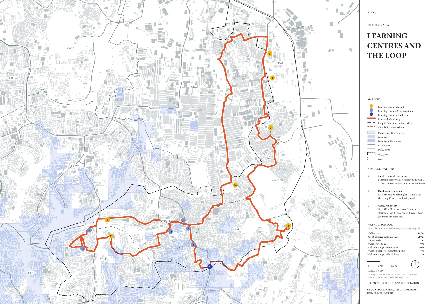
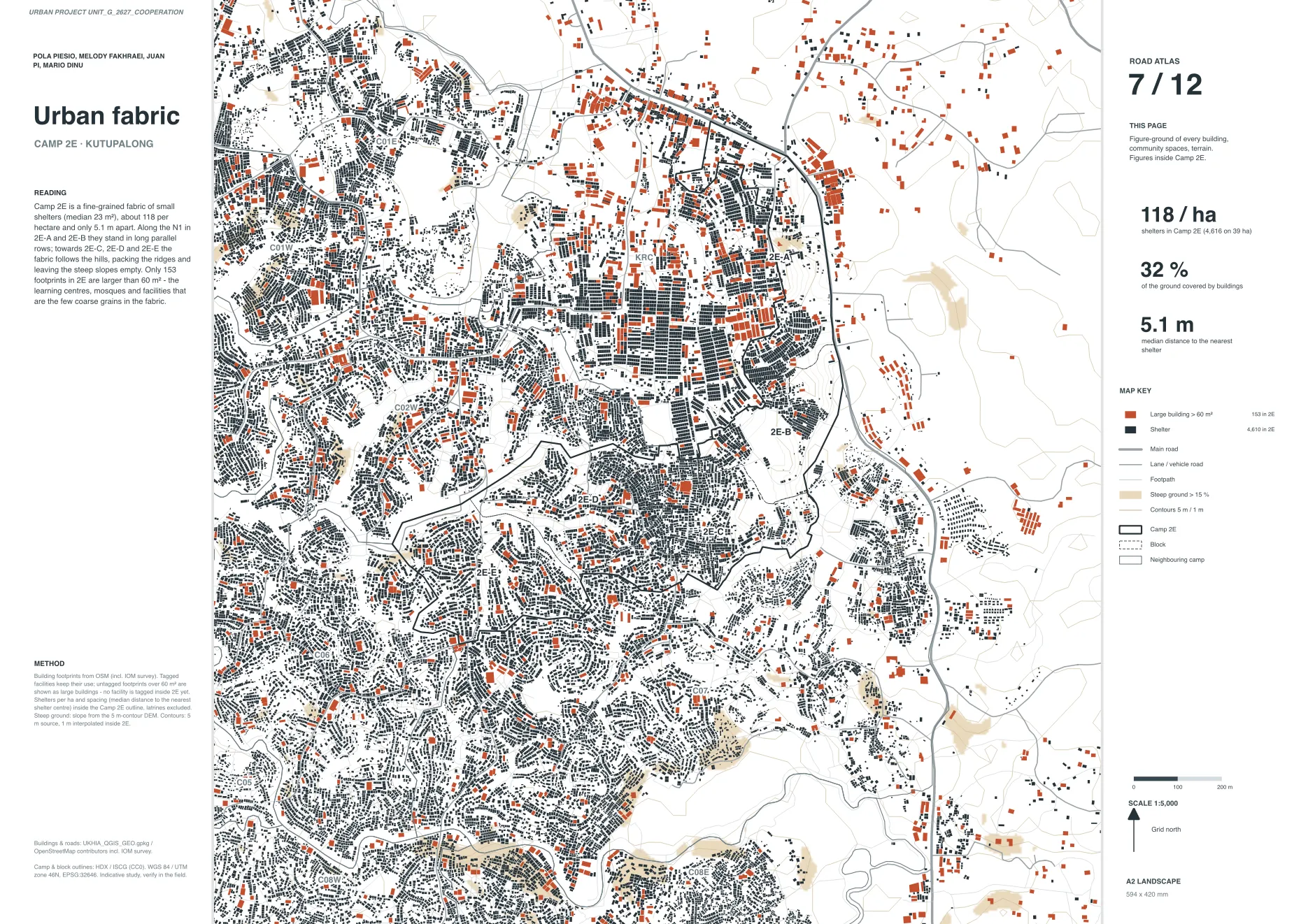
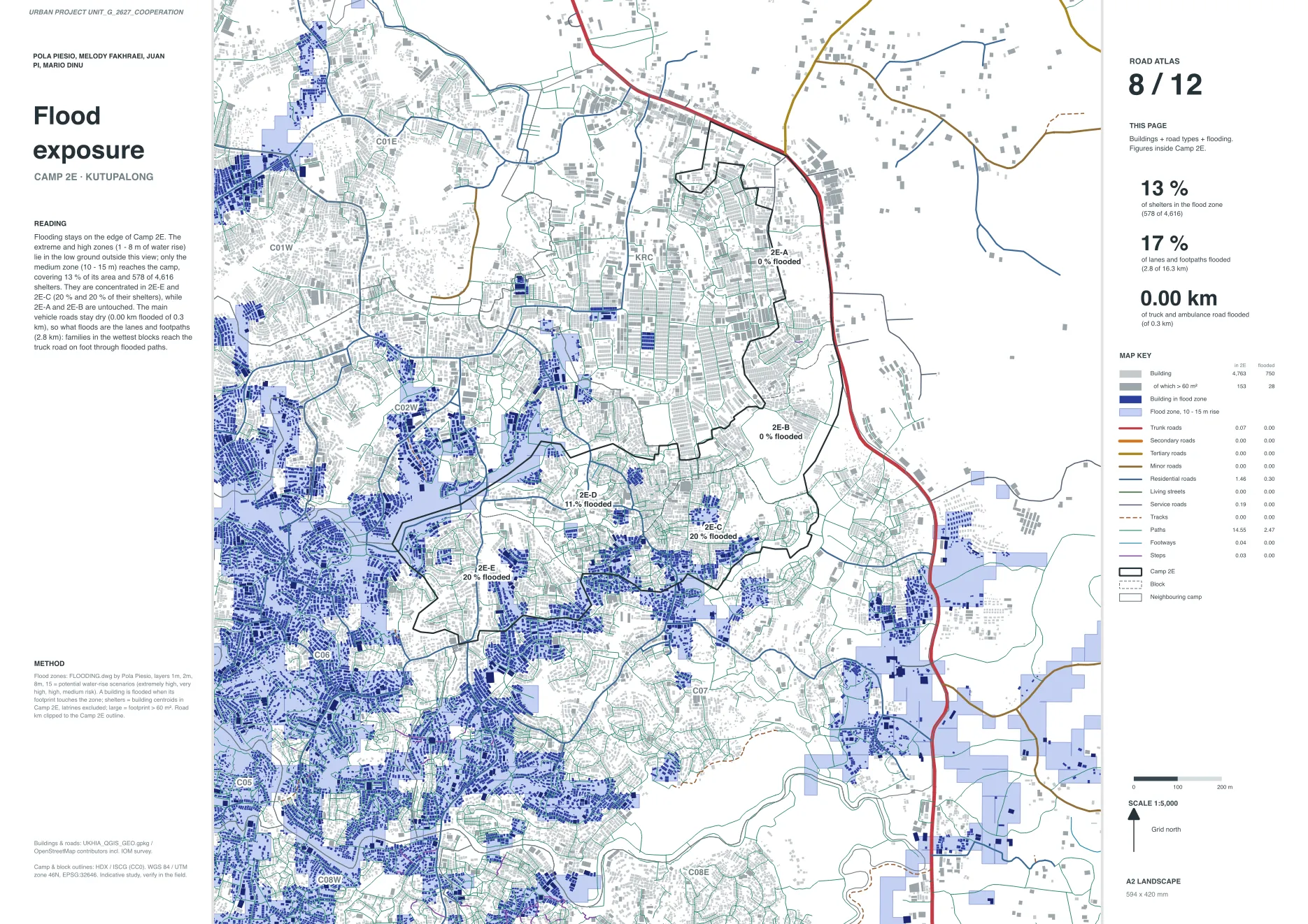
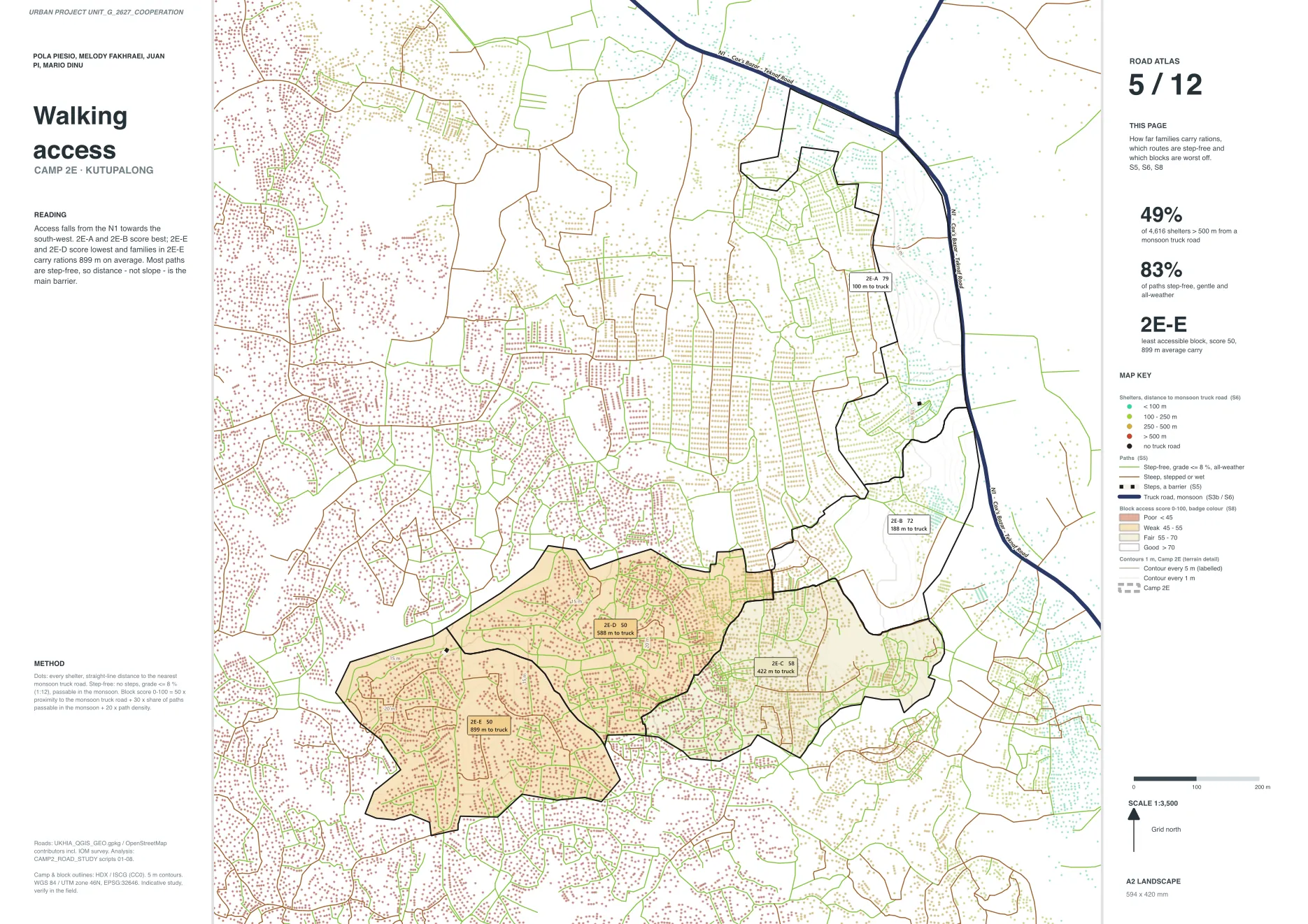
Urban cooperation studio. We mapped the learning centres of Camp 2E and drew one closed loop that keeps children off the highway, the steps and the flood zone. 92% of shelters in the camp sit within 100 m of the loop; about 190 m still crosses flood ground and has to be raised or bridged.
- Studio
- Urban Project Unit, Cooperation
- My role
- Coordinator, renders, 3D model (group of four)
- Data
- REACH, OpenStreetMap
- Tools
- QGIS, Python, AutoCAD